 Nederlands
 Dansk
Dansk Österreichisch
 Po Polsku
 Italiano
 Francaise
 Portugiesisch


Facts and Numbers about the Havelland
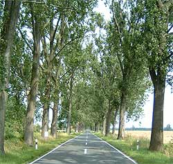
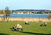
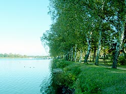
The Havelland is a landscape rich in forest and water bodies, which is dominated by the Havel flowing from the north and gives the region its name. The Havelland is situated in the western part of the Mark Brandenburg between Berlin and Sachsen-Anhalt. It originated in the course of the local government reform on the 6th of�December 1993 from the old districts of Nauen and Rathenow and stretches along on an area of�1.717. The district is bordered�in the north by the districts�Oberhavel and in the north-east of� Ostprignitz-Ruppin. In the south it borders onto the district Potsdam-Mittelmark and the town of Brandenhurg at the�Havel. The longest distance between the district borders is in the east-west direction ca 65 kilometres; in the north-south direction ca 40 kilometres.
Living inside the district are roughly 153.000 people in altogether 26 communes.� Falkensee with ca 38.000 citizens is the most populous town, followed by the district town of Rathenow�with 27.000 citizens. here is also the seat of the government administration.
The district has of course lots more well worth knowing facts to offer. 6.000 hectare are covered by water. that in turn makes�the Havelland�Germany's water richest area. 12.000 hectare Nature Reserves�safeguard the preservation of this unique natural landscape, an advantage that not only Havell�nder cherish. The highest elevation in the�Havelland is the�Gollenberg�near St�lln with 110 metres. The lowest area is ca 27 metres above sea level.


